After a quiet start to the week, steamy and stormy weather takes over.
Isolated storms will impact the tri-state area, especially during the evening hours Wednesday through Friday.
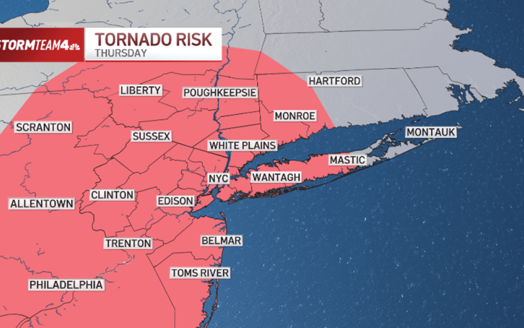
The most likely day for severe weather is Thursday, when late-day storms will be more numerous and stronger. Hail, isolated flooding, and even a weak tornado or two are possible.
The chances of a twister at this point appear to be about the same as flooding and hail risks over the course of the next three days. Damaging straight-line winds remain the primary threat.
The threat zone for an isolated weak tornado or two Thursday evening covers most of the tri-state area, so make sure to download the NBC New York app and have weather alerts turned on.
Check the latest weather alerts for your neighborhood here.
Extreme heat sets in
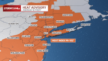
On top of the severe threat, extreme heat will blanket the tri-state Thursday and Friday afternoon.
High humidity combined with temperatures in the lower 90s will produce heat index readings between 95 and 102 degrees during the hottest part of the day.
So, when you combine 90-degree heat and dew points in the 70 range, the heat index skyrockets. On Thursday and Friday, in particular, the heat index will be between 95 and 100 degrees outside during the hottest part of the day.
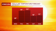
Fortunately, by Saturday humidity levels will have dropped somewhat and it won’t feel quite as hot.
In addition, rain chances evaporate this weekend, so FIFA World Cup soccer on Saturday, along with the Puerto Rican Day Parade on Sunday, should go off without a hitch.
That’s great news for those attending the area’s first World Cup soccer match on Saturday, the Puerto Rican Day Parade on Sunday, or any other outdoor activity around the region.
