It’s not exactly the welcome to summer we were hoping for.
Strong to severe storms will develop in the tri-state area Monday afternoon and evening. They pose a threat for flash flooding, damaging straight-line wind, and even an isolated tornado or two.
The threat for severe storms will be ongoing during the World Cup soccer match at New York New Jersey Stadium and the New York Mets baseball game this evening.
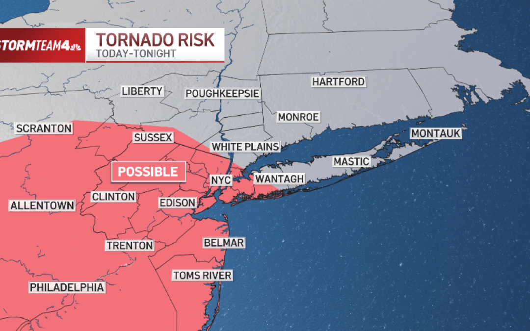
The highest risk for severe storms on Monday will be for the New York City metro area and all of New Jersey.
The threat of isolated flash flooding has prompted a flood watch for the city and points west and south.


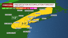
Rainfall rates from some of the strongest storms could reach one to two inches of rain per hour. At that rate, urban flooding becomes a real issue. If you live in a basement apartment or plan to take the subway this afternoon, please stay weather aware and go to higher ground if heavy downpours impact your neighborhood.
Overall, two to three inches of rain is possible from Monday’s storms.
Damaging straight line wind will also be a main threat from Monday’s storms, mainly for Central and South Jersey, but isolated damaging wind gusts could occur well into the Hudson Valley and Connecticut, too.
As for tornadoes, the risk is low, but not zero. The zone for tornado formation encompasses all of New Jersey and the New York City area. Discrete storm cells could develop rotation and produce a quick, spin-up tornado or two with winds in excess of 100 miles per hour.

To make sure you know when storms are near, download the NBC New York app, go to settings and turn on Severe Weather Alerts. That will let you know when flash flooding, severe winds or even a tornado threat are issued for your community.