It was a crazy storm inside Madison Square Garden Wednesday night as the Knicks rallied from 29 points down to take a 3-1 lead over the Spurs in the NBA Finals.
On Thursday, that storm moves outside (no, James Dolan still isn’t having a party).
Isolated storms will impact the tri-state area, especially during the evening hours on Thursday and Friday.
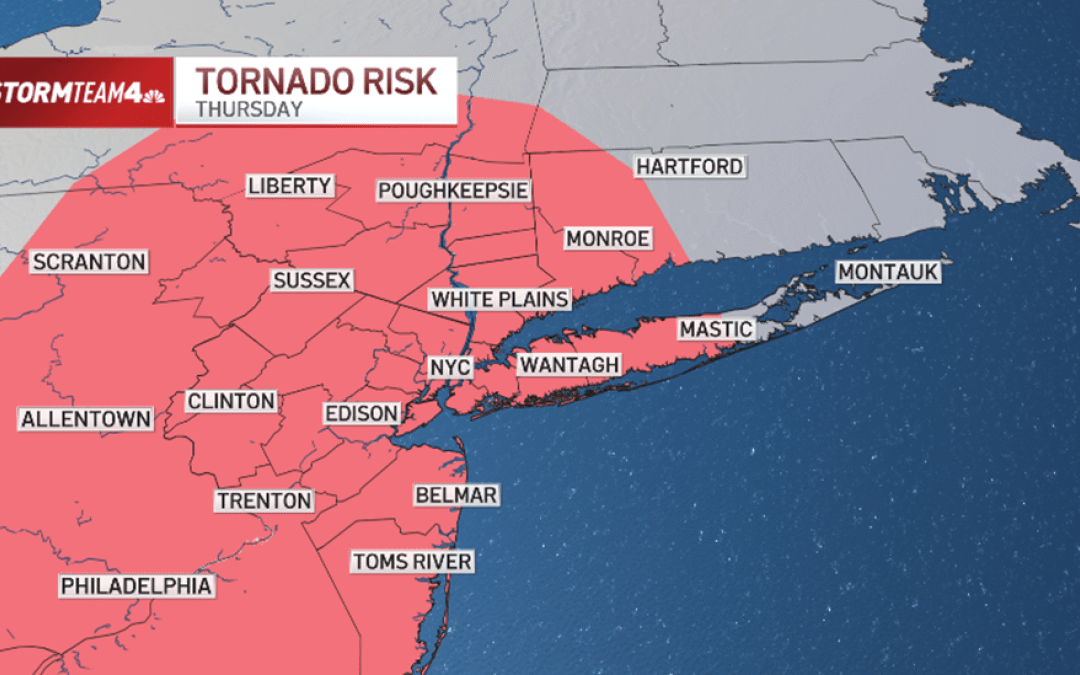
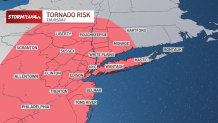
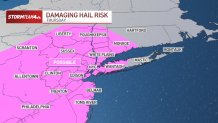
The most likely day for severe weather is Thursday, when late-day storms will be more numerous and stronger. Hail, isolated flash flooding, and even a weak tornado or two are possible.
The flash flood threat is not expected to be widespread, but rainfall rates could be intense at times, with storms capable of producing around 2 inches of rain an hour.
The chances of a twister at this point appear low but elevated. Damaging straight-line winds remain the primary threat.
The threat zone for an isolated weak tornado or two Thursday evening covers most of the tri-state area, so make sure to download the NBC New York app and have weather alerts turned on.
Check the latest weather alerts for your neighborhood here.
Extreme heat sets in
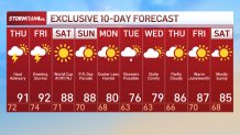
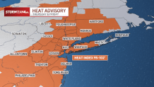
On top of the severe threat, extreme heat blankets the tri-state Thursday and Friday afternoon.
High humidity combined with temperatures in the lower 90s will produce heat index readings between 95 and 102 degrees during the hottest part of the day.
So, when you combine 90-degree heat and dew points in the 70 range, the heat index skyrockets.
On Thursday and Friday, in particular, the heat index will be between 95 and 100 degrees outside during the hottest part of the day.
A cold front Friday night brings a final round of storms that clears skies into the weekend. It’ll still be hot, but not nearly as humid — good news for players and fans ahead of Saturday’s World Cup match in New Jersey.
It’s also great news for the Puerto Rican Day Parade.